Geography ·
Where is Syracuse's geographic center?
Drop a pin where you think the middle of Syracuse is. Then open the answer to see how close you came.
Where would you put a pin if you were trying to guess the geographic center of Syracuse? Make your guess on the map, then open the answer below. Your guess stays on this page; it isn't submitted or saved.
Reveal the center and read the story
If we're measuring the city's shape, the answer is near South McBride and Jackson streets, at approximately 43.04069° N, 76.14373° W.
Here's what “middle” means for this calculation: imagine cutting Syracuse out of a flat sheet of cardboard. Every little piece weighs the same amount per square inch. The geographic center is the spot where you could balance the whole cutout on one finger. The technical name is a centroid. No scissors were harmed in this analysis.
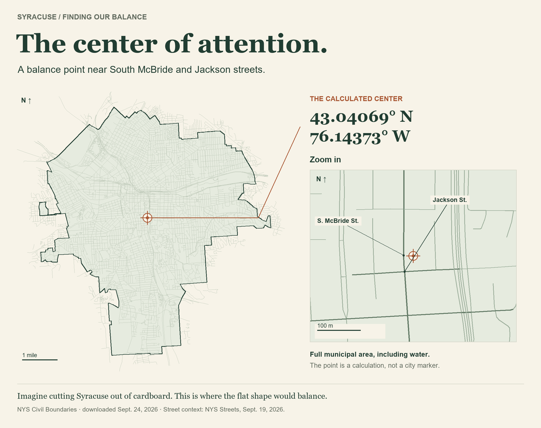
I used the full municipal boundary, including water inside the city limits. Cutting out the water would give us a different shape to balance; that's a separate, land-only question. Houses, hills and people don't add extra weight here. A parking lot counts just as much as an equally large patch of park.
That's also why you can't find this point just by eyeballing the middle of a map. Syracuse's outline has protrusions and indentations, and every bit of its area gets a vote. I checked the calculation a second way and compared two map projections; the results agreed to within about four inches. That checks the math, not the accuracy of the mapped city line.
Want to face the center from wherever you are? Open the compass below. Choose "Use my location," select a starting point on the map, or enter coordinates. It gives you a direction and the distance in straight-line miles. On a compatible phone, you can also try a compass arrow that responds as you turn. Location calculations stay on your device.
Which way is the center from me?
This is a point on a map, not a verified place to visit. But the next time someone tells you to find your center, you can at least ask whether they mean South McBride Street.
Source and method: DataCuse calculation from the NYS Civil Boundaries Cities layer, published March 2026 and downloaded September 24, 2026. Full Syracuse polygon, with water retained; area-weighted centroid calculated in NAD83 / UTM zone 18N, independently checked with polygon area formulas and compared with a CONUS Albers equal-area projection. Street context: NYS Streets, downloaded September 19, 2026, with nearby names checked against the city Streets layer. Coordinates locate a map-based calculation, not a surveyed marker. This is neither a population center nor a measure of where residents think the center is. App distances use a spherical great-circle calculation; bearings are initial directions from true north, and phone compass readings are approximate.