Streets ·
What's Syracuse's shortest street?
Two seven-letter names, one tiny lane, and a mapping wrinkle: Syracuse's shortest streets take us in three directions.
What's Syracuse's shortest street? It sounds like a straightforward question. Naturally, it sent me in three directions.
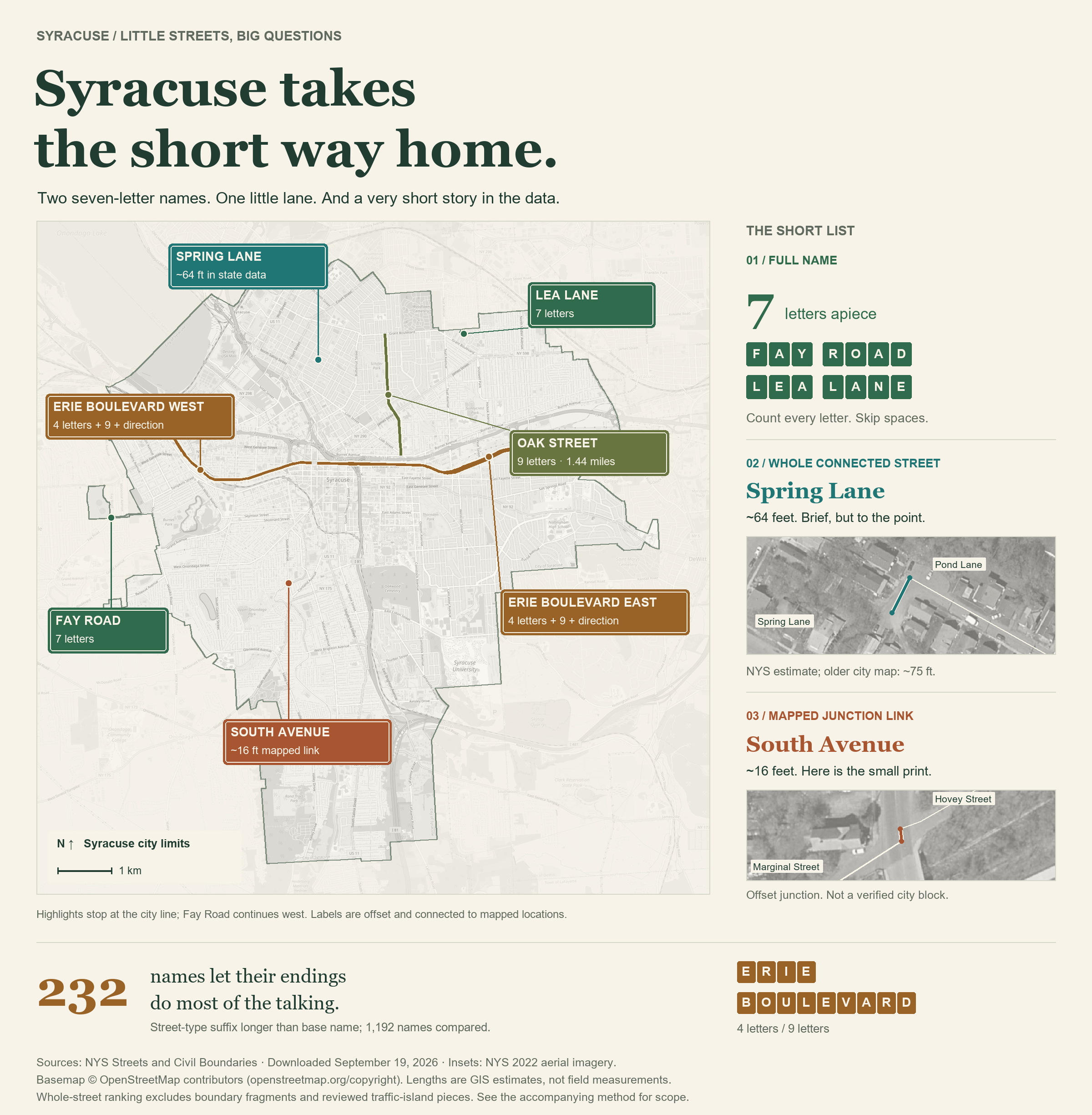
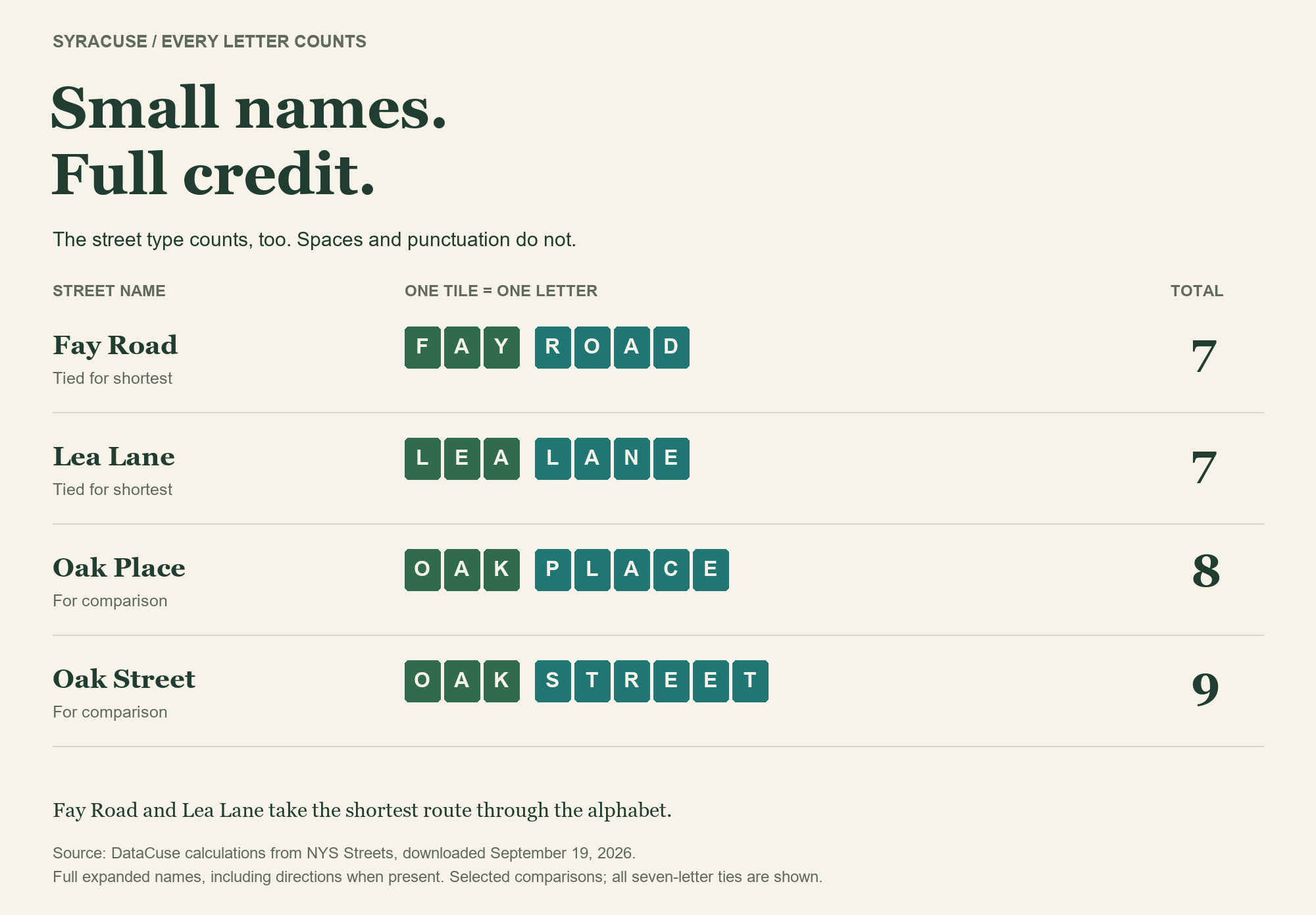
First, the shortest name, counting every letter in the full, spelled-out name. “Street,” “Lane,” and directional words all come along for the ride; spaces and punctuation stay home. Fay Road and Lea Lane tie at just seven letters. Oak Street, despite its compact three-letter beginning, needs nine. The suffix can take the scenic route.
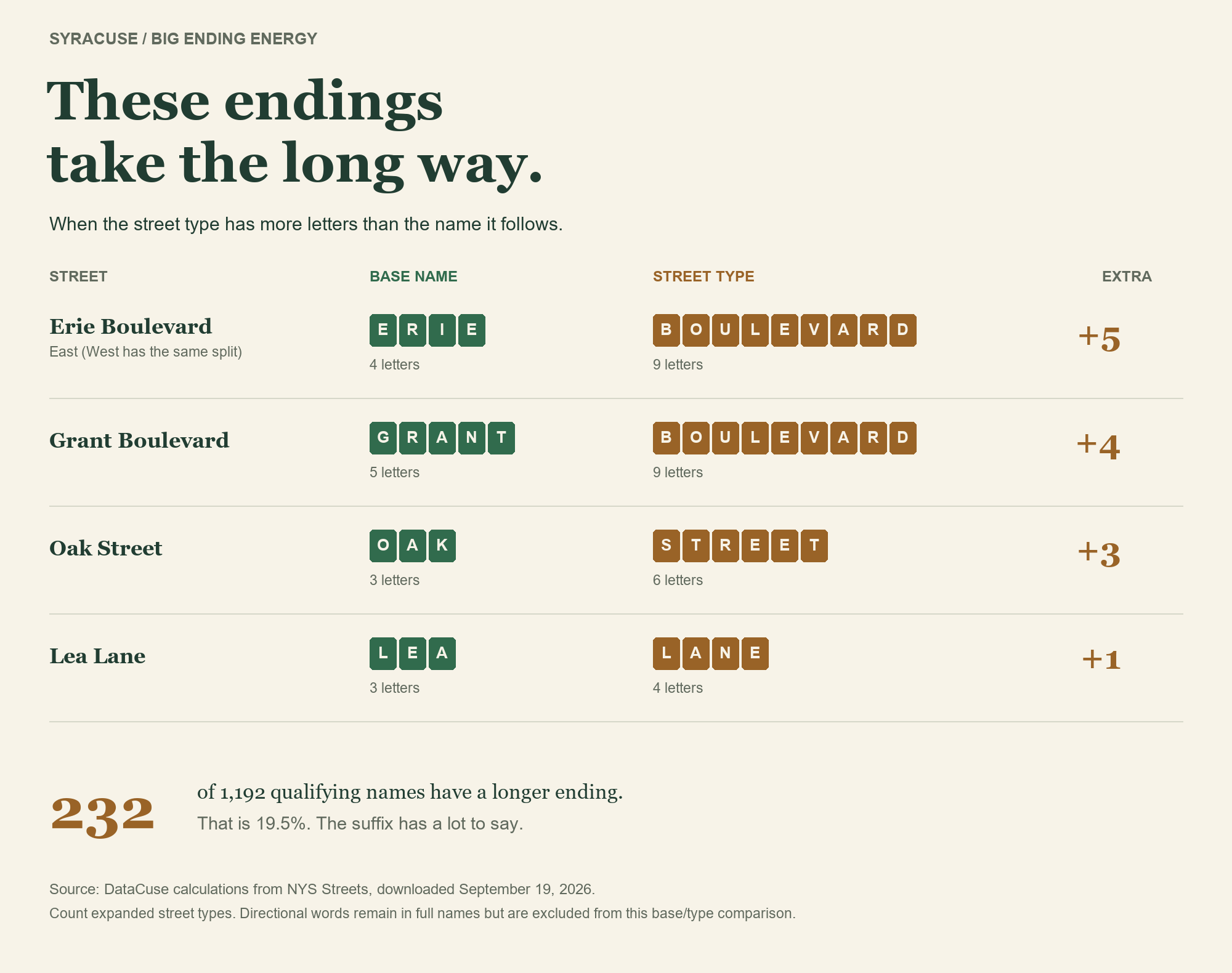
The suffixes have their own ego problem. Among 1,192 qualifying names, 232 have a street-type ending longer than the base name. Oak Street devotes twice as many letters to “Street” as “Oak.” Erie Boulevard goes further: nine letters of Boulevard, four of Erie. Talk about giving a name the runaround.
Next: the shortest block-to-block segment. Here, we hit a roadblock. The shortest mapped link between street junctions is about 16 feet of South Avenue, between Hovey and Marginal streets. Aerial imagery shows an offset junction, not a miniature conventional block. The calculation finds the shortest mapped link; it doesn't establish Syracuse's shortest real city block. We shouldn't cut that corner.
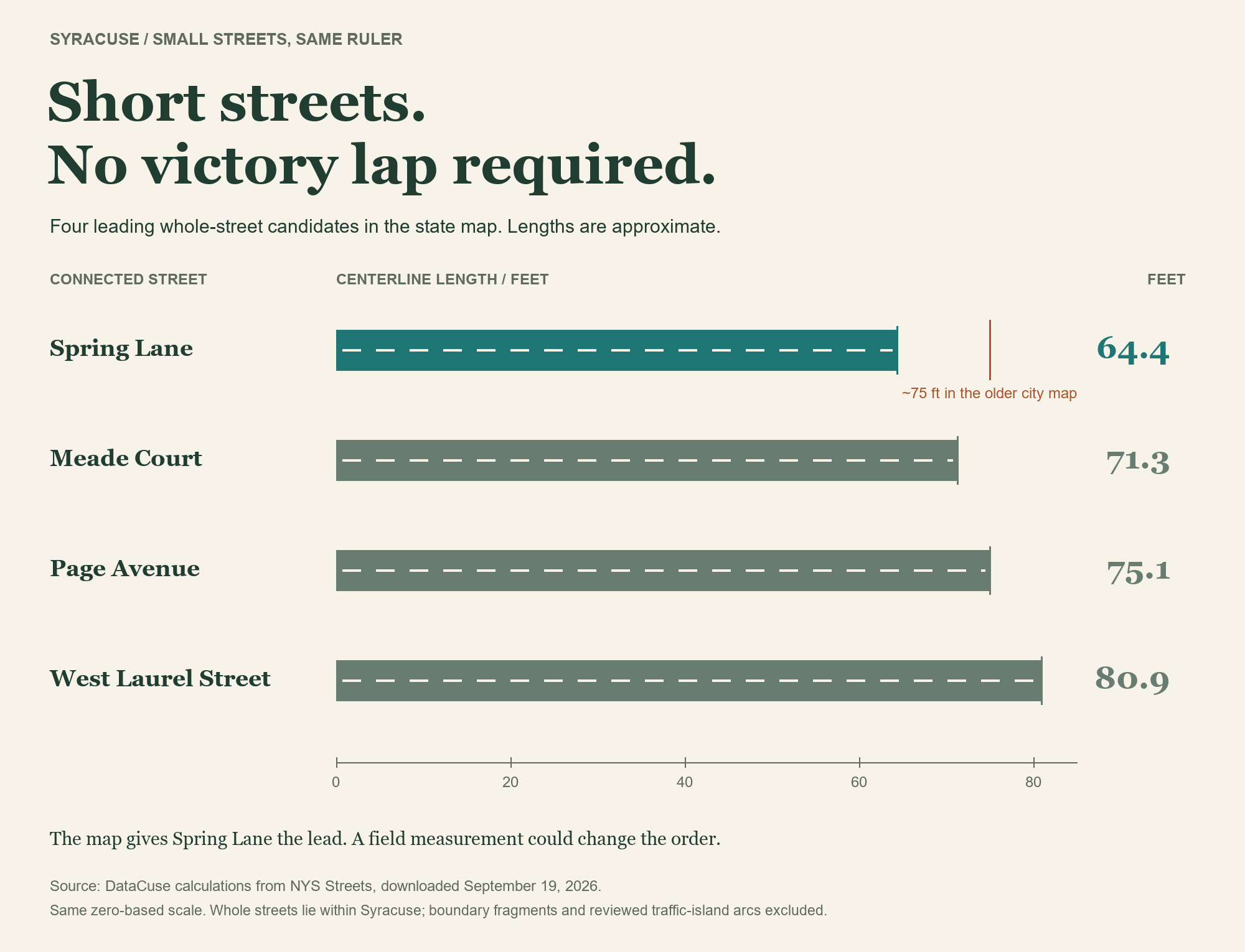
Finally, join connected pieces carrying the same name. Excluding boundary fragments and traffic-island scraps, Spring Lane, a dead end off Pond Lane on the Northside, leads the state-data ranking at approximately 64 feet. The older city map draws it at about 75 feet, so this is a map-based estimate, not a tape-measure record.
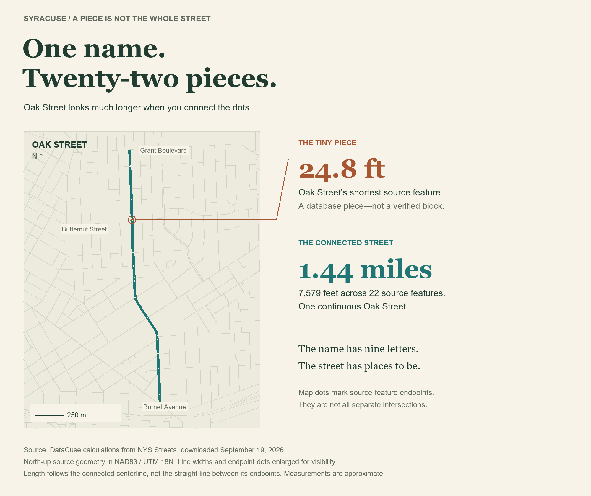
For perspective, nine-letter Oak Street adds up to about 1.44 miles when its pieces are connected. That's why we joined the blocks before judging whole streets: one short stretch doesn't tell you how far the name travels. A short name can take you a long way.
Spring Lane, meanwhile, makes its point without going on and on. A brief address, you might say.
Source and method: DataCuse calculations from NYS Streets and NYS city boundaries, downloaded September 19, 2026. Named public surface streets; private roads, ramps, driveways and paths excluded. Full-name counts include spelled-out street types and directions. Whole-street leaders must lie wholly within Syracuse. Comparison: city Streets layer. Insets: NYS 2022 aerial imagery. Basemap © OpenStreetMap contributors. Lengths are GIS estimates; no field measurement was performed.